For point cloud and triangle mesh processing
 

Products

 
...
» Standalones
 Overview
 VRMesh Studio
 VRMesh Site
 VRMesh Reverse
 VRMesh Survey
 Feature Comparison
...
» VRMesh Viewer
...
» VRMesh Plugin
...
» VRMesh Library
...
 

VRMesh Studio

It encompasses all features within VRMesh, spanning point cloud classification, feature extraction, point cloud meshing, and polygon modeling. This comprehensive workflow enhances work efficiency and significantly boosts productivity, especially in the fields of architecture, engineering, and construction.


Features and Benefits

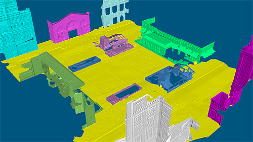
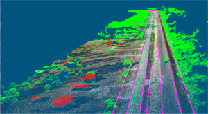
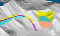
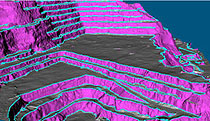
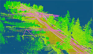
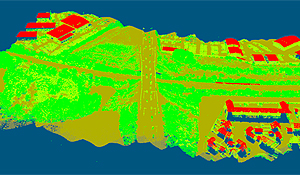
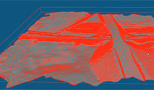
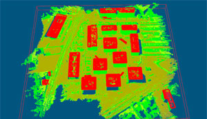
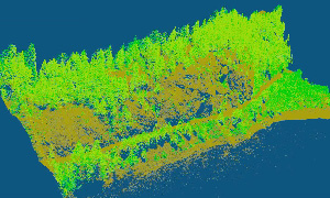
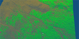
  • Classify vegetation and ground in a complex terrain automatically

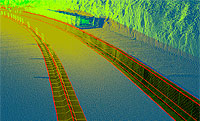
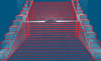
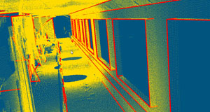
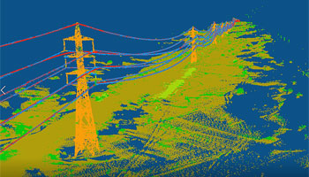
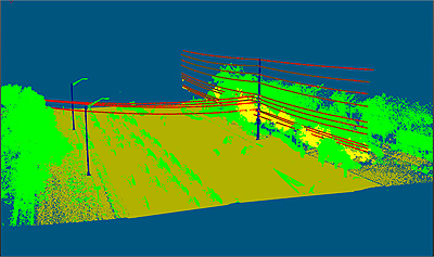
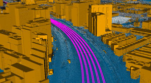
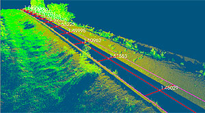
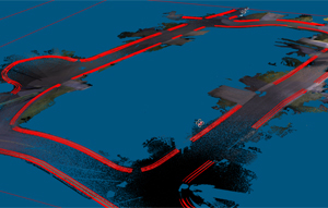
  • Extract breaklines, powerlines, poles, trees, railways, curbs, and road markings in one click

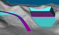
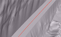
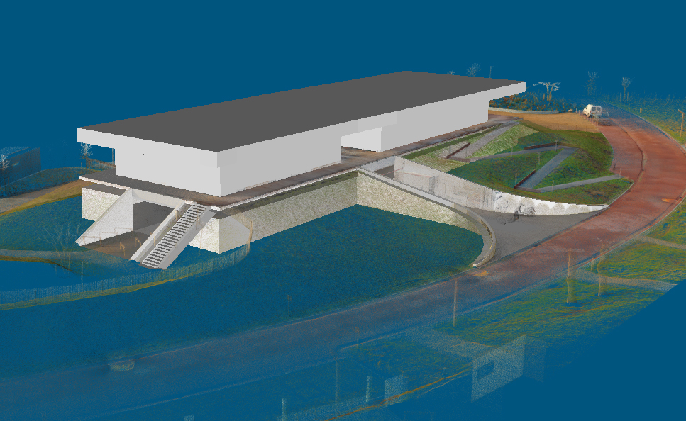
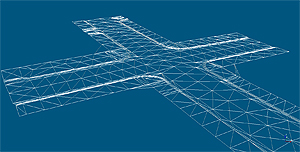
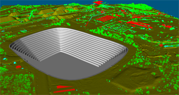
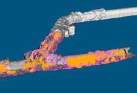
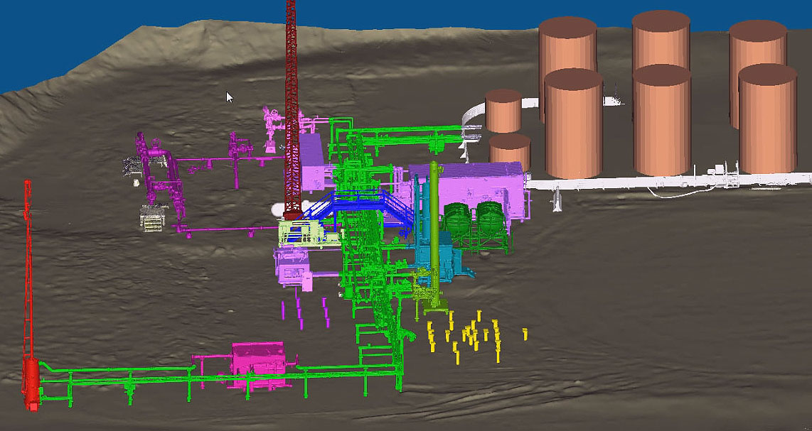
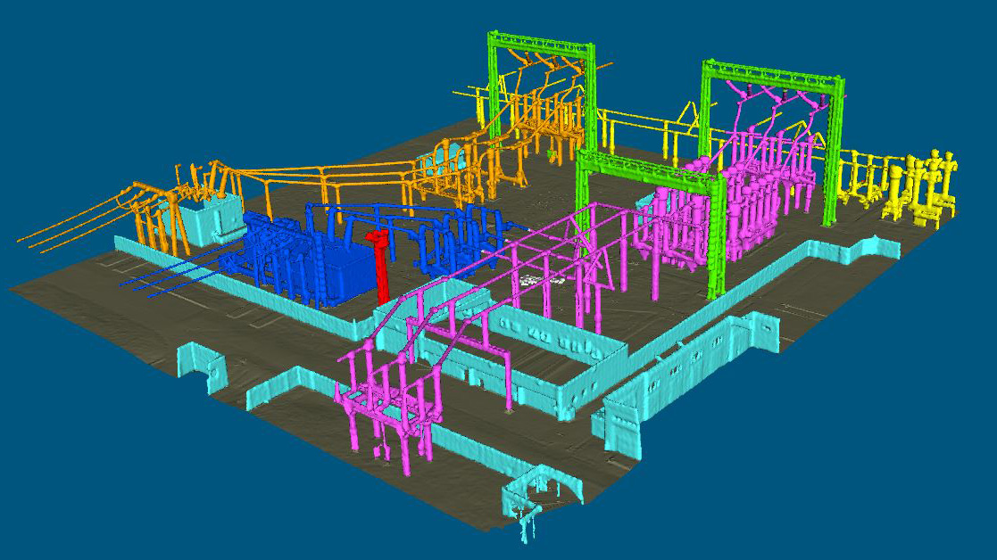
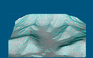
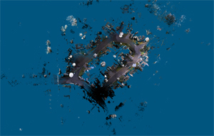
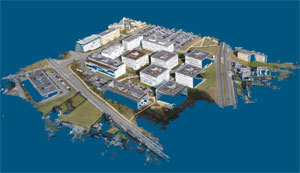
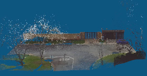
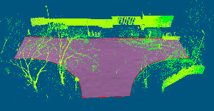
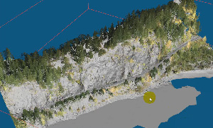
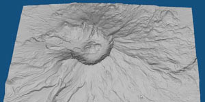
  • Convert point clouds to accurate meshes for representing original objects in great detail

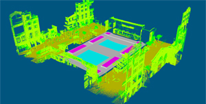
  • Convert point clouds to meshes for visualizing large-volume objects

  • Provide comprehensive mesh repair/editing tools

  • Enable the creation, editing, and optimization of polygons directly on point clouds

  • Provide LiDAR stripe adjustment and point cloud/mesh registration

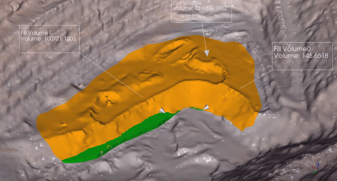
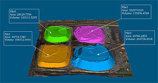
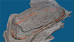
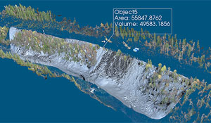
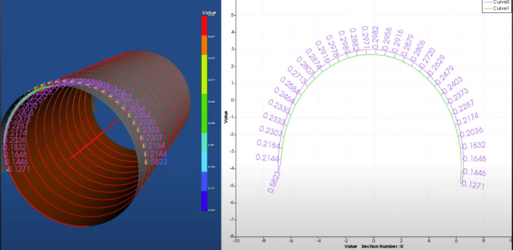
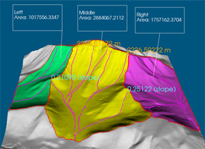
  • Provide inspection and precision measurement
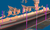
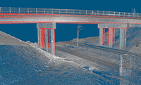
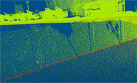

Working Examples:

>> Create an accurate mesh

Point cloud to mesh

>> Polygon modeling

Site design Underground parking modeling Curb/Ramp/Street modeling
Site design watch YouTube movie Underground parking design watch YouTube movie Curb/Ramp/Street modeling watch YouTube movie

>> Construction

Extract wall breaklines Extract curb breaklines Extract lines
Extract wall breaklines watch YouTube movie Extract curb breaklines watch YouTube movie Extract lines watch YouTube movie
 
Trace ridge/ditch Best-fit profile Road resurface
Trace a ridge/ditch watch YouTube movie Create a best-fit profile watch YouTube movie Create a road watch YouTube movie

>> Mining

Cut and Fill volume Stockpile volume Open-pit volume
 
Open-pit design Trace breaklines Volume between two scans
Open-pit design Trace breaklines watch YouTube movie Volume between two scans

>> Powerlines / Tunnels

Powerline and Transmission tower detection Powerline extraction Powerline corridor analysis
Powerlines/Transmission towers Powerline extraction Powerline corridor analysis
 
Underground tunnel Point cloud clean-up Deviation analysis
Classify point clouds Clean point clouds Deviation analysis

>> Railways

Extract Railways   Measure track gauge
Extract railways watch YouTube movie   Measure track gauge watch YouTube movie

>> Visualize large-volume objects

Visualize oil wells   Visualize electric power station
Oil field oil fields   Power station power station

>> Water catchment analysis watch YouTube movie


>> Create a clean ground surface watch YouTube movie


>> Classify large-sized terrestial laser scanning data watch YouTube movie


>> Point cloud processing for UAV images watch YouTube movie

* Point cloud data courtesy of Pix4D
 

>> Create road surface within a fence watch YouTube movie


>> Extract ground surface on a steep mountain watch YouTube movie


>> Remove vegetation & Generate an accurate meshed surface watch YouTube movie


  PRODUCTS
Overview
VRMesh Studio
VRMesh Site
VRMesh Reverse
VRMesh Survey
APPLICATIONS
Land Surveying
Construction
Mines/Tunnels
Energy/Utilities
Architecture
LEARN MORE
Feature Comparison
Download Demo
Order Online
Press Release
SUPPORT
Tutorial Videos
FAQs
System Spec
Contact Us
 
©VirtualGrid. All rights reserved. | Privacy Policy